Happisburgh Coastal Pillbox
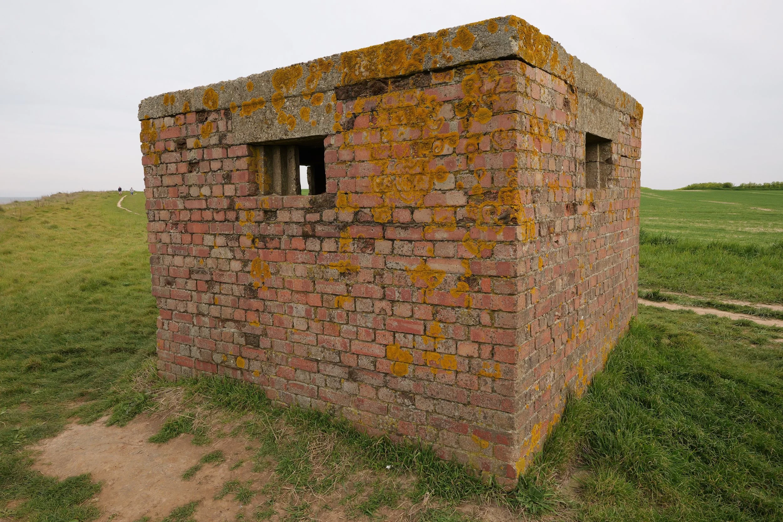
Perched on the edge of a crumbling cliff top at Happisburgh, this second world war pillbox has withstood decades of environmental erosion. I set out to digitally archive both the structure and its surrounding landscape using a combination of 3D scanning and photogrammetry techniques. The aim: to capture not just the building itself, but the environment and the terrain around it as it changes over time, providing a time-stamped reference of environmental change and the ongoing impact on a piece of English wartime heritage.

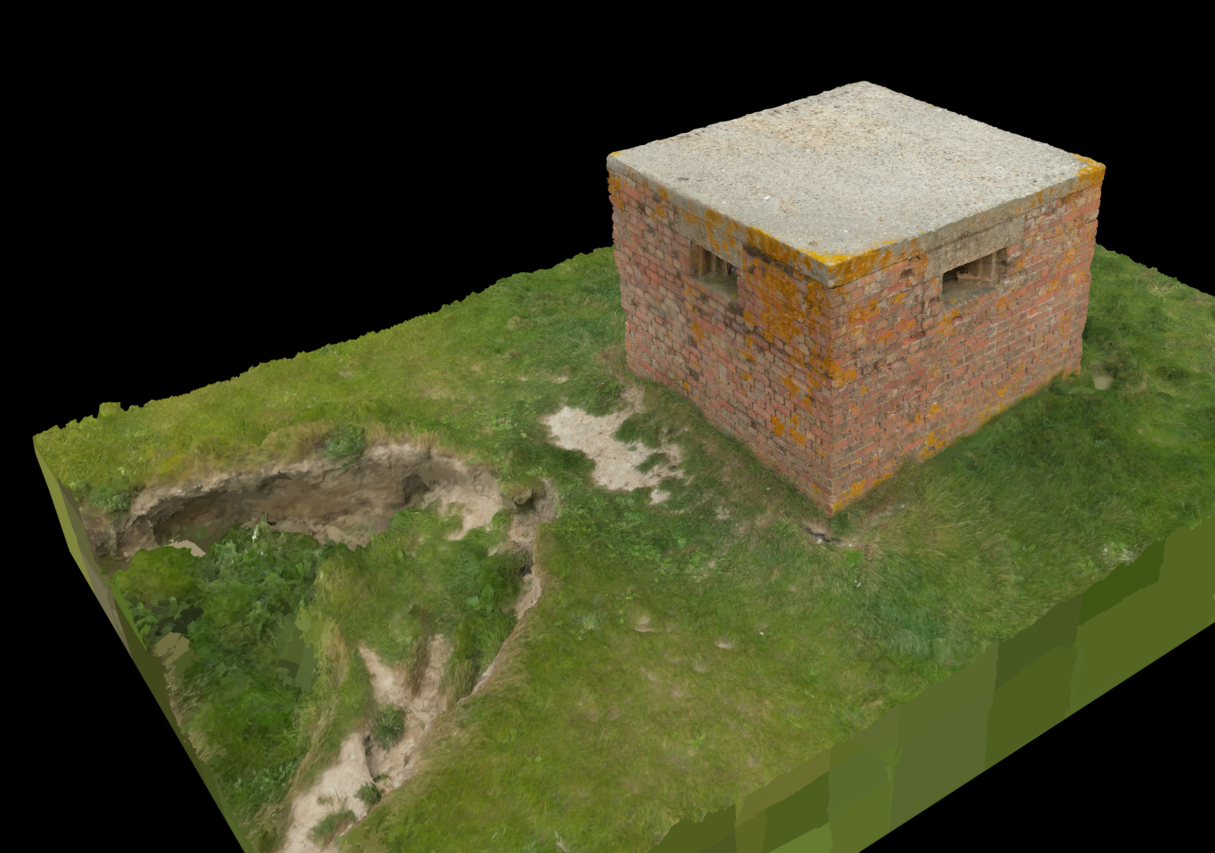
Capture Process:
Exterior Scan:
Photogrammetry with high-overlap imagery using full frame mirrorless camera, coupled with drone photography of the surrounding area.Interior Scan:
Structured-light scanning with additional close-range photogrammetry to capture surface texture, detail, and geometry.Audio:
I’ve captured hi-fidelity stereo recordings inside and out.
Why This Project Matters:
Coastal erosion is steadily consuming historic military structures around the coastline of the UK.
The enviroment around this particular structure is visibly sinking and fracturing with each season.
By capturing the full 3D geometry of the structure and its setting, I’m creating a digital record that can be compared over time, used in conservation efforts, or visualized in VR for educational purposes.
This is an ongoing project. The initial scan is complete and processed, but I’ll be returning to this site seasonally to re-scan and track change over time. Eventually, I aim to create a time-lapse model showing the erosion progressing and chronicling it’s eventual collapse into the sea.
I plan to use precisely placed georeferenced control points to help align the scans over time despite the terrain continually changing around the pillbox. I will also go back and record some spatial audio for later use in an immersive experience.